europeaks
SPAIN MULHACÉN 3479 M
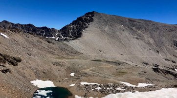
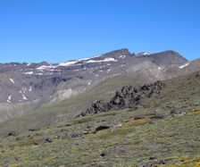
MULHACÉN FROM HOYA DEL PORTILLO
Mulhacén (Spanish pronunciation: [mulaˈθen]) is the highest mountain in continental Spain and in the Iberian Peninsula. It is part of the Sierra Nevada range in the Cordillera Penibética.
It is named after Abu l-Hasan Ali, known as Muley Hacén in Spanish, the penultimate Muslim King of Granada in the 15th century who, according to legend, was buried on the summit of the mountain.
Mulhacén is the highest peak in western Europe outside the Alps. It is ranked 64th in the world by prominence. The south flank of the mountain is gentle and presents no technical challenge, as is the case for the long west ridge. The shorter, somewhat steeper north east ridge is slightly more technical. The north face of the mountain, however, is much steeper, and offers several routes involving moderately steep climbing on snow and ice (up to French grade AD) in the winter.
RECENT POSTS
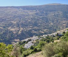
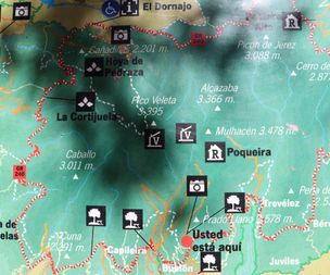
2019-06-11 While I was on a family trip to Nerja I took take the opportunity to climb mainland Spains highest mountain, Mulhacén 3479 m. I started my journey early in the morning at 6 am from Nerja. Two hours later I was at the starting point, Parking Hoya del Portillo. To get here you pass through a very cute village called Capileira (1432 m) the last one before the steeper mountain part begins.
At the parking I met a girl from the Netherlands who also were going to the summit of Mulhacén. We decided to make company and later on it turned out that we were almost the only people on this route this day.
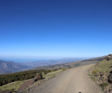
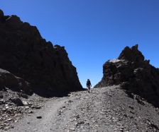
There are some different routes to choose. You can also chose to take a bus to a spot called Mirador de Trevlélez (2700 m) and from there you can make it to the top on less than 3 hours. I chosed to walk that part so thats why I parked at Parking Hoya del Portillo and at the beginning we just walked on the small bus road. It was beautiful but the road was not that much exciting.
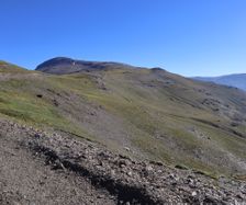
To reach the summit from Parking Hoya del Portillo it will take you around 4 hours. Since we were walking pretty fast we thought we will reach the top earlier. But when the clock had passed 12 and we just started to see the summit from a closer perspective my company from the Netherlands decided to turn back since she had a flight to catch from Malaga in the evening.
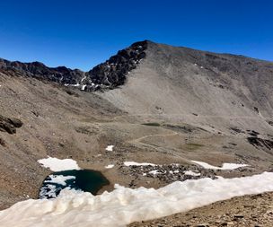
I decided to continue solo and in the beginning I had a bad gut feeling. I didn't see a single person. Usually I run into people but here it was totally desolate. I kept walking even faster, and I hadn't stoped for a break at all from the morning. I was confused about that it had taken such a long time and how I could misjudged the distance. After five hours of hiking I was close to the top, of what I thought was Mulhacén.
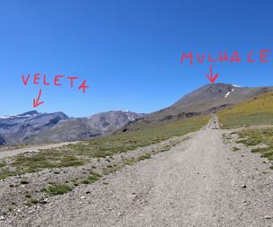
At that moment I met the first people from where me and the girl from the Netherlands went seperate ways. It was two mountainbikers who came from the other side of Sierra Nevada where the ski lifts and the slopes are. When they were close I pointed at the top, and wanted them to confirm that I finally soon where reaching the top of Mulhacén. And they answered "No no, this Pico del Veleta. Mulhacén over there...." and they pointed hell far away. I was not a little bit wrong, I was totally wrong.
Pico del Veleta is Sierra Nevadas second highest top, 3396 m. This means 81 meters difference. All my energy ran out of me when I realized I had climbed the wrong mountain. Not surprised anymore that it had taken me such a long time than it was supposed to take to Mulhacén. I realized I won't make it to the right summit since my rental car had to be returned at 7 pm in Nerja.
I started to descent in the direction back to where I came from. I was so dissapointed about my big misstake and that I had been so careless about checking the map. Such a big lesson learned to always check the map even if I am sure I am going for a obvious summit. I tried to stay positive and encourage myself about the experience I had here in Sierra Nevada.
Short after I had decided to give up I met a brittish guy. He was on his way to the top of Mulhacén and he had started from the other side where the mountainbikers came from. He was very positive and said he is planning to reach the summit around 3 pm. At this moment the time was around 1 pm. So I thought it sounded reasonable and fair, I might make it. So I chosed in last minute to go with him with the consequence to not return the rental car the same day. The extra payment will be a problem to take care of later. Now I was here after such a long traveling and hiking so I had to take the opportunity.
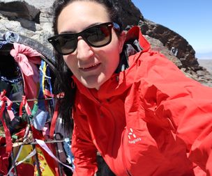
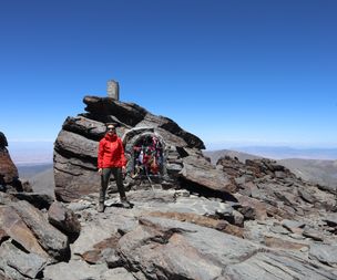
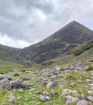
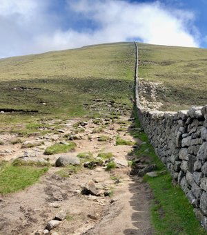
We made company for a while but on the last part where the trail started to get a little bit more steep I told him to not wait for me. I only had less than one deciliter water left and a banana and snickers in my bag. I definitly had a hard time breathing both because of the height and the cold I had the whole week after Slieve Donard and Carrauntohil the weekend before. Finally at 3.20 pm I reached the summit of Mulhacén! The highest peak in mainland Spain. What a feeling and what a view. It was definitely worth the effort.
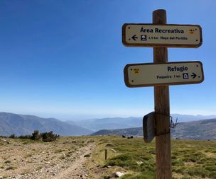
I took a short break on the top, ate half of my snickers and just a little bit of my deciliter of water I had left. I decided to save the last splash for my 4 hours walk back to the car. It took me around 2,5 hours back to the car and on that way I only saw two people and that was when I had around 2 kilometers left to the parking. Maybe they were on their way to Refugio Poquira (2500 m) where you can spend the night if you want to make Mulhacén to a 2-day hike.
Back at the car I realized I had walked 39 km and I had been out for 10 hours, only with one real break at the summit. What a day! I was so happy and satisfied over my achievment and grateful that I finally reached my aim. Totally dehydrate with only 0,8 litres water during the whole day I drove to Capileira where I bought water and then back two more hours to Nerja.
For you who wonder about the car. I just had to pay extra for half a day since I was back in Nerja when they had closed the rental office. It was totally worth it!
Summit number 14.
© All rights reserved.

